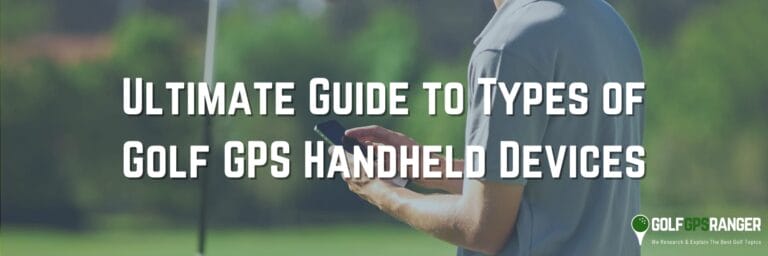
Ultimate Guide to the Best Golf Handheld GPS Devices

!!!!DISCLAIMER!!!! This site may contain Amazon & other affiliate links.
This means if you click on one of the product recommendation links, this site may receive a small commission. This is at no extra cost to you and may include exclusive discounts when possible. This helps support this site and allows us to keep making content like this. Thank you for your support!
Golf technology has revolutionized the way we approach the game, and handheld GPS devices have become essential tools for golfers of all skill levels. As we look ahead, the market is filled with innovative and feature-packed GPS devices designed to elevate your golf experience.
In this comprehensive guide, we’ll explore the best golf handheld GPS devices, highlighting their key features, benefits, and how they can help you make informed decisions on the course.
Whether you’re a beginner looking to improve your game or a seasoned pro seeking a competitive edge, this article will provide you with the insights you need to find the perfect golf GPS device to suit your needs.
Get ready to take your golf game to the next level with the latest advancements in golf technology.
Insights from the Guide
- Understanding the role of golf handheld GPS devices in enhancing on-course strategy.
- Exploring the practical benefits golf GPS technology provides to golfers of all skill levels.
- Insights into how modern golf GPS devices offer accurate distance measurements and hazard identification.
- Recognizing the importance of integrating a GPS device into your golfing toolkit for game improvement.
- Introduction to the wealth of information and features accessible through golf GPS devices.
- Anticipating how advances in golf gps technology continue to revolutionize the golfer’s experience.
The Evolution of Technology in Golf
The game of golf has changed a lot thanks to the evolution of golf technology. Golf equipment has moved from simple wooden clubs to high-tech gear. This gear uses the latest materials and design ideas. Metal woods, better golf balls, and advanced making methods have made the sport more precise and fun to play.
Golf technology made a huge jump with electronic devices like rangefinders and GPS systems. These devices give golfers key info about distances and course features. Before, golfers had to guess these based on their own experiences or simple guesses. The start of these electronic aids was a key moment in the evolution of golf technology. It mixed old traditions of the sport with new digital help.
Talking about GPS technology’s impact on golf, it has changed how golfers play the game. Players now have access to detailed maps, exact distances to the pin, and data on their shots. This info improves how they play strategically. The growth of technology in golf keeps going, with new software that helps players review and improve their game after they play.
- Wooden Clubs to Space-Age Metals: The transformation from hickory shafts to titanium heads showcases significant strides in materials and engineering.
- Evaluation of Rangefinders: Emergence and maturation of laser rangefinders boosted the precision of golfers’ distance gauging abilities.
- GPS Innovations: Shift from basic distance aids to sophisticated systems providing comprehensive course detail and shot analysis.
- Software and Apps: Mobile applications and software for swing analysis, game tracking, and virtual coaching.
Today’s golfer is at a key point between old ways and new tech, using the latest golf technology to make the game even more appealing. As the evolution of golf technology goes on, golf lovers will see more breakthroughs. These will push what we think is possible in the game to new heights.
Handheld GPS Devices for Golf
Golfers at all skill levels are now using tech to improve their play. Handheld GPS devices for golf stand out for their useful features. They combine satellite tech with course maps. This gives players real-time data and helpful insights. No matter if you’re an amateur or a pro, gps devices for golf can help. They provide exact distance measures, warnings about hazards, and track scores.
There’s a wide range of golf GPS devices available today. For those who like it simple, there are small, clip-on devices. They give you basic yardage info. For others, there are devices with full-color, touch screens. These not just measure distance but also log scores, analyze swings, and more. With so many options, every golfer can find a GPS device that fits their needs.
“Not only do these devices tell you the distance to the green, but they also aid in course strategy by revealing the layout of unseen hazards or the contour of the green.”
| Device Type | Basic Functions | Advanced Features | Price Point |
| Basic Handheld GPS | Front/Center/Back of Green Distances | None | Budget-Friendly |
| Advanced Handheld GPS | Comprehensive Yardage Details | Score Tracking, Swing Analysis | Mid-Range |
| Premium Handheld GPS | Full-Feature Distance Tracking | Virtual Caddie, Full Color Maps | High-End |
The rise of gps devices for golf shows a move toward a more data-driven game. Golfers are better informed, thanks to these devices. They make smarter, more strategic choices during play. As tech improves, these devices are becoming must-haves on the golf course. They help golfers at all levels improve their scores and enjoy the game more.
Importance and Benefits
GPS devices have changed golf for both experts and beginners. They offer advantages that improve play significantly. With benefits of golf GPS devices, players understand the course better. This helps them make accurate shots and plan better strategies. These tasks would be hard to do on their own.
- Improvement in Shot Accuracy and Distance Measurement
- Golf GPS gadgets provide precise distance to the green’s front, middle, and back. This helps choose the right club.
- Knowing the exact distances improves decision-making. This leads to better control and results in shots.
- Strategic Advantage on The Course
- A GPS gives a bird’s eye view, helping avoid unseen hazards. It shows the best routes on each hole.
- Some models save past game data. Golfers can use this to better their strategies for future games.
- Enhanced Course Management
- GPS tools help understand the layout and distances of hazards, bunkers, and the flagstick. This betters course management.
- This knowledge allows for proactive choices. It often lowers the number of strokes taken.
- Improving Overall Performance
- The advantages of using a GPS device in golf also include a mental edge. Trusting the tool lets golfers focus on playing.
- Regular use promotes a systematic way to golf. This can lead to lasting improvements in how well someone plays.
Using a GPS tool in golf brings real advantages and changes how players approach every shot. It helps with club selection, navigating the course, or bettering practice times. Golf GPS tools are an essential part of a golfer’s gear.
Understanding Golf Handheld GPS Devices
The game of golf has changed a lot with new technology. Especially, golf GPS devices have become very important. They help golfers know exactly where they are and how far they are from the hole. These devices show detailed maps and tell about places to avoid, like water and sand. This information helps both new and experienced players make better choices when they play.
What to Look Out For
- Insight into the functionality and benefits of golf handheld GPS devices.
- Guidance on making use of advanced features for strategic gameplay.
- Understanding the importance of accurate distance measurements for improved performance.
- Comparative analysis of golf handheld GPS devices versus traditional course measurement methods.
- Ways to integrate technology into golf practice for skill enhancement.
- An outline of the evolution from basic rangefinders to today’s multifunctional devices.
Definition and Basic Functions
Definition of a golf handheld GPS device starts with understanding its key purpose. It’s a small, hand-held tool that helps golfers improve their game. It does so by giving useful course info and distance figures. Through using satellites, it accurately measures distances to key spots like greens, hazards, and fairways. This gives players a big boost in planning their game and choosing shots.
Looking into how golf GPS devices work shows their reliance on GPS technology. This involves a set of satellites that orbit Earth and talk to devices to find precise spots. A golf GPS device takes satellite data to pinpoint where the golfer stands on the course. It then shows distances to hazards or the next hole using stored course maps. This mix of satellite signals and device maps forms the core of how they work. This makes playing golf much easier for everyone.
| Feature of Golf Handheld GPS Device | Description | Benefits to Golfers |
| Distance Measurement | Calculates exact distances to greens, hazards, and doglegs | Enables precise club selection and strategy formulation |
| Course Maps | Detailed renderings of the golf course layout | Provides a bird’s-eye view of the course for better planning |
| Satellite Synchronization | Connects with global satellites to determine position | Delivers real-time, accurate location data to the user |
| Hazard Identification | Highlights the location of sand traps, water hazards, etc. | Aids in navigating around potential trouble spots on the course |
| User Interface | Easy-to-navigate screens and menus | Simplifies the process of accessing and utilizing device features |
To add more, a golf handheld GPS device isn’t just for measuring distance. It’s a full golfing tool giving data-driven advice for smarter course actions. These devices have evolved to give golfers quick, right-on data. This helps cut down strokes and makes the game more fun.
Key Features and Capabilities
Today’s golfers have a great helper: a golf handheld GPS device. These devices have key features and capabilities that are crucial for anyone on the course.
- Distance Measurement: GPS devices give exact distances to many parts on the course. This includes the greens and points like bunkers and water hazards.
- Hazard Identification: They help players understand the course layout. This includes showing bunkers, water hazards, and areas that are out of bounds.
- Course Maps: They provide detailed maps of each hole. This helps players plan their next move with more confidence and accuracy.
- Shot Tracking: Some GPS devices can record and track every shot. Players can then look at this data to find areas to improve.
- Scorekeeping: They make keeping score easier by using a digital platform. This means moving from hole to hole without needing a paper scorecard.
- Statistical Analysis: Beyond keeping score, these devices offer advanced analytics. They track your performance over time, showing your strengths and weaknesses.
These GPS devices also have extra features like Bluetooth for notifications, smartphone compatibility for detailed analysis, and weather forecasts. Below is a table summarizing these capabilities.
| Feature | Description | Benefit |
| Distance Measurement | Accurate yardages to greens and points of interest | Strategic shot planning and club selection |
| Hazard Identification | Insight into course layout and potential hazards | Improved hazard avoidance and course management |
| Course Maps | Visual layout of each hole | Enhanced understanding of the course topography |
| Shot Tracking | Record and analyze shot direction and distance | Insights on shot consistency and areas to improve |
| Scorekeeping | Digital scorecard to track scores and statistics | Convenient score management and history review |
| Statistical Analysis | Detailed statistics on gameplay | Data-driven decision-making and strategy development |
These key features provide golfers with all the info they need during play. The capabilities of these devices help the modern golfer make smart choices and improve their game.
Golf GPS Devices, Rangefinders, and Traditional Methods
As golf tech has grown, so have tools for measuring course distances. Golf GPS devices and rangefinders offer advantages over traditional methods. Knowing the differences can help golfers pick the best tools for their game.
Traditional methods vs. golf GPS devices: Traditional methods involved manual guessing, yardage books, and on-course markers. Golfers had to trust their judgment and static info. Today’s golf GPS devices give live data, including course layouts and specifics, which old-school methods can’t.
Differences between golf GPS devices and rangefinders: Rangefinders, using lasers, give precise measurements for specific shots. Golf GPS devices give overall course views, including distances to greens and hazards. Golfers choose based on whether they want detailed shot planning or a broad strategy.
| Tool | Pros | Cons | Best For |
| Golf GPS Devices | Comprehensive course data, ease of use, strategic planning | Dependent on satellite signals, may require subscriptions | Players who want a strategic layout and course navigation |
| Rangefinders | Precise distance to the flag, not dependent on maps | Limited to visual range, less useful for blind shots | Players needing accurate, point-to-point measurements |
| Traditional Methods | No technology required, purely skill-based | Time-consuming, less accurate | Purists and players who enjoy a traditional golf experience |
Choosing between these tools depends on a golfer’s style and tech preference. While GPS devices give a broad view, rangefinders focus on shot precision. Traditional methods offer the game’s classic challenge but with less benefit than tech tools.
Source: Todaysgolfer’s Review on Distance Measuring Device and GPS Systems
Choosing the Right One
As the sun rises above the course, a golfer thinks about their next move. Knowing the distance to the pin, where hazards lie, and the course design is key. These details could be game-changers. The right golf handheld GPS device can give players an edge. With just a click, doubt turns into assurance. We’ll guide you in picking a golf GPS that not only boosts your performance but also matches your style and tech needs.
Things to Remember
- Identifying factors that influence the choice of a golf handheld GPS device for enhanced gameplay.
- Understanding the significance of device accuracy for reliable distance measurement on the course.
- Assessing the importance of user-friendly interfaces and the impact on the user experience.
- Comparing devices based on essential features such as preloaded courses and subscription services.
- Highlighting top brands and models to consider during the selection process.
- Addressing battery life considerations for uninterrupted use during rounds.
- Exploring the advantages of advanced GPS features like shot tracking and scorekeeping for strategic play.
Factors to Consider
Choosing the right golf GPS device involves several factors to consider when choosing a golf GPS device. Accuracy is key; a device with precise measurements can change how you play. Another big issue is battery life. You need a device that lasts a full round of golf or more without recharging.
The important features of golf GPS devices also include ease of use. A simple interface makes playing golf smoother. The number of preloaded courses matters for golfers who like variety. Finally, consider whether you need a subscription for extra features or course updates, which could cost more over time.
| Feature | Why It’s Important | What to Look For |
| Accuracy | Essential for making informed decisions on the course. | Devices with high sensitivity GPS receivers. |
| Battery Life | Should last for at least one full round of golf. | Long-lasting battery, possibly with a power-saving mode. |
| Ease of Use | Quickly accessible features improve user experience. | Intuitive interface with straightforward navigation. |
| Preloaded Courses | Convenience and readiness to play various courses. | Devices with a wide selection of courses available out of the box. |
| Subscription Service | Affects long-term cost and access to extra features. | Transparent service offerings with clear benefits. |
Knowing about these factors to consider when choosing a golf GPS device and the important features of golf GPS devices helps make a smart choice. It means picking a device that fits your style and need for course support.
Popular Brands and Models
Searching for the right golf GPS gadget can be tricky, like finding a path on a tough golf course. Garmin and Bushnell are popular brands of golf GPS devices known for their quality and innovation. Their models are top-rated for top models of golf GPS devices, blending advanced technology with easy-to-use features. For golfers looking for precision, these brands offer devices that improve scores and help with course management.
| Brand | Model | Key Features | Unique Qualities |
| Garmin | Approach S62 | Color touchscreen, PlaysLike Distance, 41,000 preloaded courses | Virtual caddie, Health monitoring |
| Bushnell | Phantom Golf GPS | Preloaded with 36,000 courses, Easy-to-read front/center/back distances | BITE Magnetic Mount, Bushnell Golf App included |
| Garmin | Approach G80 | All-in-one premium GPS golf handheld with integrated launch monitor | Practice and game modes, Touch targeting |
| Bushnell | ION 2 | Bluetooth integration, Auto course recognition, and hole advance | Long battery life, Fitness tracking capabilities |
These devices do more than just give yardages and course info. They also offer extras like fitness tracking and phone alerts. These top models of golf GPS devices provide detailed stats for players focused on getting better. They help with understanding your distance, accuracy, and game patterns.
From the advanced Garmin Approach S62 to the easy-to-attach Bushnell Phantom Golf GPS, there’s something for everyone. Each model has features that can help any golfer use technology to play smarter.
Tips on Selecting a Device
Finding the best golf GPS device for you involves thinking about various features. These features can greatly impact your golfing. Below, you’ll find some key tips to help choose a golf GPS device that meets your specific needs on the course.
- Assess Your Gameplay Style: Think about if you want a simple device for distance or a complex one with detailed maps and tools.
- Important Features: Decide what features you must have. Do you need info on hazards, tracking of shot distances, or a digital scorecard?
- Budget Constraints: Figure out your budget early. Even though devices with lots of features are tempting, many affordable ones are great too.
- Usability: Pick a device that’s easy to use. Devices with a user-friendly interface can boost your focus and gameplay.
- Research and Reviews: Spend time reading reviews and checking golf forums. Feedback from other users can be very helpful in your decision.
Here is a comparison table showing different features of golf GPS devices. This table isn’t complete, but it shows some key differences. It can help you decide based on your preferences and how you manage your game.
| Feature | Benefit | Consideration |
| Preloaded Courses | Access to many courses without needing downloads. | Does it include the courses you often play? |
| Touchscreen Display | Easy navigation and simple use. | Check if it works well in different lighting. |
| Battery Life | It lasts many rounds before needing a charge. | Make sure it fits your usual play time. |
| Waterproofing | It’s protected against bad weather, for use anytime. | Think if you play often in rain needing this. |
| Add-on Services | Gives updates and more on courses. | Are these extra services worth the cost? |
| Size and Portability | Easy to carry and doesn’t hinder play. | Decide what size and weight you’re okay with. |
With these tips on choosing a golf GPS device and thinking about your gameplay, you can make a smart choice. Remember, the goal is to pick a device that enhances your golf experience. It should suit your unique way of playing by using the right tech.
Source: Golfmonthly’s Review of The Best GPS Devices
Maximize the Use of Your Handheld GPS Device
Technology and sports are mixing in new ways, making golfers better equipped than before. With golf handheld GPS devices, they can take their game to another level. These devices help players understand their game better, make smarter choices, and get ahead on the course.
Learning to use a golf GPS device well could help you achieve your best performance. This part of our guide will show you how to set up and get the most from these tools. You’ll learn how to use all their features to improve your game.
Important Notes
- Get familiar with the foundational functions and settings of your device for a solid start.
- Explore advanced device features such as shot tracking and statistical analysis.
- Learn tips for integrating GPS data with your golf practice routines and strategies.
- Utilize your device to create a comprehensive game improvement plan.
- Stay up to date with software updates to ensure your device’s performance is top-notch.
- Discover methods to protect and maintain your golf handheld GPS device for longevity.
Setting Up Your Device
Starting with the setup of a golf GPS device is an exciting step to improve your golf. This guide will help you set up your golf handheld GPS device for the best performance. It’s perfect for those new to golf gadgets or already tech-savvy.
First, ensure your device is fully charged. A full charge makes setup smooth and keeps the device ready for the course. After charging, connect your golf GPS to a computer or smartphone. You can do this via USB or Bluetooth, based on the device you have.
Next, you’ll need to download any apps or software updates your device needs. These updates are crucial for your golf GPS to work well. They let you get course updates and track scores. Here is a simple table explaining these important steps:
| Setup Stage | Description | Pro Tip |
| Fully Charging Your Device | Ensure the device is charged to 100% before using. | Charge overnight to guarantee a full battery for your time on the course. |
| Connecting to a Digital Companion | Link your golf GPS device to either a computer or smartphone. | Regularly check for device firmware updates to improve accuracy and add new features. |
| Downloading Necessary Apps | Install any apps or software that enhance the device’s capabilities. | Explore the app store for additional golf-related apps that may complement your device. |
By following these steps, you’re not just setting up a golf GPS device. You’re also making it the best assistant on the course. Remember, the setup is as important as a good swing. Take your time, follow these steps, and enjoy a better golfing experience with this technology.
Advanced Features to Explore
Thanks to advancements in golf GPS devices, players now have access to amazing features. These tools do more than just measure distance. They change how golfers play by offering deep insights into their game. Learning to use advanced features on a golf handheld GPS device can really boost a player’s game.
Shot tracking is a key advanced feature of golf GPS devices. It records every shot, helping players see what they need to work on. Scorekeeping has moved to the digital world, making it easier to keep track of scores. Devices also provide stats like putts per round and fairway hits, helping golfers know what to improve.
- Shot Tracking: Learn about shot distances and accuracy to pick clubs better.
- Scorekeeping: Digitally track scores and see how you’re doing over time.
- Statistical Analysis: Check out stats to get better at different parts of your game.
To really benefit from advanced features of golf GPS devices, take time to see how they fit with your playing style. Look at what today’s top devices offer:
| Feature | Benefit | Example of Use |
| Shot Tracking | Improves club selection and swing consistency | Analyzing the average distance and accuracy of drives with your driver versus three-wood. |
| Scorekeeping | Streamlines the scoring process and archives scores for review | Reviewing past rounds to identify trends in scoring on specific holes or courses. |
| Statistical Analysis | Provides actionable data to focus practice sessions | Identifying that work is needed on par 3 performance after analyzing greens in regulation percentages. |
Using advanced features on a golf handheld GPS device lets players closely examine their game. New players can find key areas to improve right away. Experienced golfers can adjust their strategy for the win. While golf relies on skill and practice, these advanced features offer a big advantage not found in old methods.
Integrating the Device with Your Golf Practice and Strategy
A Golf GPS device is more than just a tool for knowing distances. It brings your practice sessions to another level by offering precise data. This data helps improve your game significantly. By using a golf handheld GPS, you can discover new ways to enhance your skills. Intentional use during practice gives you insights that can make you perform better in real games.
Incorporating a golf handheld GPS device into your strategy means making your shots more accurate. Use it to select targets and practice shots as if in a real game. Then, record your shots with your device’s feature to review later. This technology pinpoints areas for improvement and helps you establish a consistent shot routine.
A Golf GPS is also great for building a smart course management strategy. Knowing the course layout and hazards beforehand prepares you for tournament pressure. It helps in better club selection by teaching you the real distances of each club under different conditions. The info gathered builds a game plan focusing on your strengths and weak points.
| Practice Focus | How a Golf GPS Can Help | Expected Outcome |
| Shot Accuracy | Measures the distance to target for consistent practice. | Improved precision with irons and wedges. |
| Course Familiarity | Provides detailed layouts and hazard positions. | Enhanced on-course strategy and foresight. |
| Club Selection | Records true shot distances per club in various conditions. | Better judgment in club choice, reducing mishits. |
| Performance Tracking | Logs practice round statistics for review. | Identifies trends and areas needing improvement. |
Remember, being consistent is essential. Using a golf GPS device regularly helps blend these strategies into your muscle memory and decision-making. This makes your tactics in golfing become like second nature. By adding a golf handheld GPS to both training and real matches, your game improves a lot. This way, the line between technology and skill becomes hard to see.
Golf GPS Technology and the Impact on Gameplay
Golf GPS devices have changed the game in big ways. They have made strategies better and improved the game on the green. By looking into how these devices have impacted gameplay, we learn how GPS technology has revolutionized golf. Thanks to this tech, players can make smart calls with precision. They no longer just rely on their sight; they know distances and foresee hazards with the help of these tools.
Insightful Tips
- GPS technology offers unsurpassed precision in distance and course layout measurements, directly influencing shot accuracy and club selection.
- The strategic aspect of golf has been refined as players utilize data from their golf GPS devices to make more informed decisions on the course.
- Through the detailed hazard recognition provided, golfers can better navigate courses and avoid potential penalties.
- Golf GPS devices contribute significantly to pace of play, as golfers spend less time estimating distances and more time executing shots.
- The psychological edge gained from the confidence in having accurate course data should not be underestimated in its impact on a golfer’s performance.
- Understanding the historical transformation brought about by these devices underscores their value in contemporary gameplay.
Personal testimonials
Golfers everywhere have talked about their experiences with golf GPS devices. They say these gadgets have greatly improved how they play. These devices offer instant data that helps players make smarter choices on the course. Through personal stories, we see the real effect of technology on golf.
“Since integrating a golf handheld GPS device into my rounds, I’ve shaved off several strokes from my handicap. It’s like having a personal caddy that knows the course inside and out.”
There’s clear evidence that using these devices boosts performance. Golfers share how golf handheld GPS devices have helped them. They manage distances and spots to avoid with more skill. Knowing the course well leads to better decisions on which club to use and changes in strategy. This increases confidence when playing.
- Improved course management through precise yardages
- Enhanced understanding of individual club range
- Lowered scores through strategic hazard avoidance
These devices are a goldmine for those wanting to better their game. They offer deep analysis and data after each round. This data helps players see where they can improve over time.
Performance Improvement
Recent advances in golf tech, especially handheld GPS devices, bring revealing data on performance improvement with golf GPS devices. They show how effective these devices are. Numerous studies focus on the statistics on the impact of golf GPS devices. These studies prove that GPS devices greatly sharpen golf skills.
| Study | Average Score Reduction | Accuracy Improvement | Course Management Enhancement |
| Golf Tech Labs Analysis | 2.5 strokes | 10% | Significant |
| International Golfing Index Research | 2 strokes | 15% | Moderate |
| GPS Impact Survey 2022 | 3 strokes | 18% | Considerable |
| Pro Golf Synopsis Report | 1.8 strokes | 12% | High |
Stats show a trend: golfers are getting better at their game. Thanks to these devices, players make fewer mistakes. Studies like one by Golf Tech Labs Analysis found golfers cut an average of 2.5 strokes. And accuracy? The GPS Impact Survey 2022 reported a precision boost of 18%.
These statistics on the impact of golf GPS devices are convincing. They suggest golfers of all skills should use these tools. Better accuracy and smarter play lead to a notable performance upgrade. The widespread use of golf GPS devices signals a shift to a more analytical game, blending tradition with new tech.
Future Trends
The world of golf technology is always changing. Future advancements in golf GPS devices are going to change how golfers play. New features focus on accuracy and working with other tech are leading the upcoming trends in golf technology.
Experts believe AI and machine learning could make course strategy more personal. They could adjust to how a golfer plays in real time. Also, mixing GPS devices with virtual and augmented reality could change training. Golfers might practice on digital versions of real courses before playing them.
Improved golf GPS devices will make the game better for golfers. They will offer insights for a smarter approach and better skills.
- Integration with wearables for full performance tracking
- Real-time environmental data for smarter shot advice
- Social features to share and compete online with friends
Here is a table showcasing some expected features and improvements:
| Anticipated Feature | Potential Benefit | Likely Impact on Gameplay |
| Augmented Reality (AR) integration | Immersive course visualization and training aid | Improved course familiarity and strategic practice |
| Enhanced battery life and sustainability | Longer play-time with eco-friendly options | Reduced interruptions, continuous data collection |
| Automated shot tracking | Detailed insights into each shot | Personalized data for game improvement |
| Wearable device synchronization | Consolidated fitness and golf performance metrics | Comprehensive health and game analytics |
These upcoming trends in golf technology promise an exciting future. They will bring together equipment, software, and analytics in new ways. Future advancements in golf GPS devices are set to start a new era. This era will offer precision and fun for golfers everywhere.
Maintenance and Care
Maintaining your golf gear is key, especially with tech like maintenance for golf GPS devices. A golf handheld GPS device is a big buy for any player. Taking care of it boosts its function and life. This article section shows you how to care for your golf handheld GPS device. With these tips, you can trust your device for accurate help during your golf games.
Helpful Tips
- Understanding the essentials of maintenance and regular care for peak device performance.
- Learning about daily care routines that can extend the life of your golf GPS device.
- Identifying common troubleshooting issues to quickly get back on the green.
- Navigating the update and upgrade processes to maintain a current and efficient device.
- Discovering how maintenance plays a role in the usability and reliability of your device during play.
Daily Care Tips
Keeping your golf handheld GPS in top shape ensures it works well and lasts longer. Simple steps can help keep it functioning right and accurate. Let’s go over tips and habits to keep your golf GPS device in great condition.
- Clean the Screen Regularly: For the best view and use, keep the display clear. Use a soft microfiber cloth to wipe off marks and smudges.
- Protect Against Impacts: Guard your device with a case or cover to prevent damage from drops or bumps.
- Avoid Extreme Temperatures: Don’t leave your GPS in the sun or a hot car, as high heat can harm its electronics.
- Keep the Battery Charged: Keeping the battery charged means your device is always ready. Don’t let the battery fully drain, as it may weaken over time.
Proper storage of your golf GPS when not in use is key to its longevity. Store it in a place that’s cool and dry, away from dampness that can damage internal parts. Doing so helps keep your device performing well and dependable for years.
Remember, caring for your golf GPS can save money down the line by avoiding expensive fixes or the need to buy a new one.
Following these maintenance tips for golf GPS devices enhances your game with accurate data and course insight. Take good care of your device. It will help improve your golfing skills.
Common Issues and Troubleshooting
Having trouble with your golf handheld GPS? Knowing some troubleshooting tips for golf GPS devices can help a lot. Players often face common problems that can affect their game and device use. These include connection issues, wrong distance readings, and devices that freeze or crash. Quick solutions are needed to fix these and get back to the game.
Fixing common problems with your golf handheld GPS is something you can often do on your own. Here’s a detailed guide to tackle the most usual issues:
- Connectivity Issues: If your GPS can’t connect to satellites or the phone app, check if the device’s software is up to date. If it still doesn’t work, try resetting it. Make sure you’re in a clear area, away from things that could block the signal.
- Inaccurate Readings: Wrong distance data can ruin your experience. Often, recalibrating the GPS can fix this. Also, ensure your device’s maps and course information are up to date to avoid errors.
- Device Freezing/Crashing: If your device stops working or crashes, a soft reset might solve it. If not, you might need to factory reset it, as instructed by the manufacturer. Note, this could delete all your data and settings.
Staying on top of your device’s maintenance and knowing these steps can help solve most problems. But, if issues keep happening, reaching out to your device’s customer support can give you more help to troubleshoot your golf GPS device.
Using these troubleshooting tips when needed ensures you enjoy your game without any hitches, keeping faith in your golf GPS device’s performance.
Update and Upgrade Practices
Keeping your golf GPS device updated is key to its accuracy and performance. By updating, you get the latest courses and features. This makes sure any problems are quickly fixed. Upgrading your golf handheld GPS can also bring new tech that improves your game.
Updating your device’s software and firmware is usually easy:
- Connect the device to your computer with a USB cable or through Bluetooth, if you can.
- Go to the maker’s website and look for support or downloads.
- Download the latest update for your model.
- Follow the instructions on your screen to install the update.
Make sure to check for software updates often. Doing so keeps your device working well. There are several benefits to updating and upgrading on time:
| Benefits of Updates | Advantages of Upgrades |
| Access to the latest course data and maps | New features that enhance user experience |
| Improved accuracy of existing features | Updated hardware for better durability and reliability |
| Bug fixes and performance improvements | Advanced technologies for more precise data |
Think about these things when upgrading your golf GPS device:
- Performance: Check if the new model works better and is more reliable.
- Features: Look for extra features that could improve your game.
- Price: Make sure the upgrade is worth the cost and fits your budget.
If you choose to upgrade, research the latest models and compare them. This helps find the best one for your golfing needs. Upgrading can give you more precise data and a better grasp of the course. This can lead to a better scorecard in the end.
“Regular updates keep you ahead in the game. Upgrades can completely change your golfing experience.”
The Power of GPS Technology
As we wrap up our discussion on golf handheld GPS devices, we’ve seen a big change. This change shows how tech can make golf more fun and improve how we play. We’ve looked closely at these tools and their growing importance in golf.
Valuable Lessons
- The invaluable precision and convenience offered by golf handheld GPS devices.
- Improved strategic decision-making on the course facilitated by real-time data.
- The ways in which technology has streamlined the learning curve for golfers of all levels.
- Significant gains in performance metrics through the effective use of GPS technology.
- The continuous evolution and integration of new features in golf GPS devices.
- Encouragement of a more enjoyable and engaged golfing experience.
- A look forward to future innovations that promise to further elevate the game.
Importance of a Golf Handheld GPS Device
The importance of golf GPS devices is clear when we talk about improving your golf game. They give detailed yardage info and insights on the course. This helps golfers plan their game better. Understanding the value of golf handheld GPS devices means seeing how they help you play. Let’s look again at the key benefits these devices add to the green.
- Enhanced accuracy for shot-making decisions
- Strategic course management
- Real-time data for better club selection
- Simplified user experience over traditional methods
Whether a novice golfer or a seasoned pro, a golf handheld GPS device equips players with precise navigational tools needed for an elevated game.
Here’s a look at how these devices have changed parts of the game:
| Aspect of Golf | Without GPS Device | With Handheld GPS Device |
| Measuring Distances | Estimations based on physical markers | Precise measurements to greens, hazards, and doglegs |
| Course Management | Decisions based on experience and guesswork | Informed decisions backed by topographical data |
| Shot Selection | Based on assumed yardage | Strategic selection utilizing accurate device data |
| Tracking Progress | Manual recording and analysis | Automated tracking and sophisticated performance analytics |
In conclusion, these examples show the importance of golf GPS devices as must-haves on the course. They’ve become essential for players who want to improve their strategy. The value of golf handheld GPS devices stands out. They provide a wide range of functions that up your game.
Technology for Improving Golf Skills
Golf is changing, and so is how we use new tech to get better at it. A key part of this change is using technology to improve golf skills. Golf GPS devices are a big example. They are now a must-have for players at every level. The help from golf GPS devices in skill improvement is huge. They give players important info that can help lower their scores.
Technology has teamed up with sports to give golf a new level of detail and analysis. These tools do more than measure distances. They provide data on swings, the layout of courses, and how you play. To see the impact of technology on golf, let’s look at what GPS devices offer:
- Exact measurements to greens, obstacles, and key spots help golfers choose the right club.
- A digital buddy suggesting clubs based on your history and current conditions.
- Feedback on your playing trends, showing what you’re good at and what needs work.
Golf GPS devices make important info easy to get on the course. This saves time analyzing games and planning strategies. The use of these tools shows how golf is moving forward. It’s a mix of tradition and new ideas.
“Embracing technology in golf is not about diminishing the challenge; it’s about equipping golfers to rise to it with greater insight and precision.”
How a golfer moves from beginner to expert often depends on their openness to new methods and tools. Here’s how golfers using tech stack up against those sticking to old ways.
| Traditional Golfer | Tech-Savvy Golfer |
| Relies on yardage books and manual calculations. | Uses a golf GPS device for instant, precise distance measurements. |
| Depends on visual cues and experiential guesswork. | Leverages detailed course maps and hazard information from GPS data. |
| Tracks scores and performance manually, potentially missing patterns. | Employs digital tracking to analyze and improve gameplay systematically. |
The difference is clear: embracing technology boosts skill and deepens game analysis. Golf’s digital age invites everyone to use these tools and thus improve their game dramatically. The takeaway is simple: don’t be afraid of using technology to improve golf skills. Embrace the role of golf GPS devices in skill improvement. Let technology transform your game.
New Advancements in Golf Technology
Golf GPS devices have come a long way, signaling a bright future of golf technology. Everyone, from beginners to pros, acknowledges their impact. These devices have changed how we plan and play, making our game precise with data.
We’re moving towards exciting times with augmented reality, wearable tech, and AI. Soon, golf gadgets might give us swing tips in real time. This progress shows golf’s dedication to adopting technology, which improves our play on the green.
- Current insights help fine-tune precision and course management.
- Emerging tech may bring real-time data analysis to the forefront.
- The melding of AI with golf gear could offer on-the-spot coaching.
Everyone agrees golf GPS devices are crucial for today’s players. But the thrill lies in the future possibilities of these tools. Seeing technology push forward makes us excited about tomorrow’s game innovations.
“Mastery resides in the ability to embrace new tools for old games.”
Golfers are unique, but we all look forward to the future of golf technology together. A revolution is near, with advancements ready to enhance our sport.
When choosing a golf GPS device, consider factors like accuracy, ease of use, battery life, course availability, and extra features like shot tracking and app integration. By embracing this technology, golfers of all skill levels can take their game to the next level and enjoy a more rewarding experience on the links.
Frequently Asked Questions (FAQs)
Q: What are the best golf handheld GPS devices?
A: The best golf handheld GPS devices include notable models like the Bushnell Phantom 2, the Garmin Approach S70, AIM W12 Golf smartwatch, Bushnell Wingman, SkyCaddie SX550, Garmin Approach G80, and the Bushnell ION Elite GPS Watch. These devices lead the golf market with their advanced features, accurate GPS distances, and easy-to-use interfaces.
Q: How do GPS watches improve your golf game?
A: GPS golf watches improve your golf game by providing accurate distances to the front, center, and back of the green, allowing you to choose the correct club and approach for each shot. They also often feature course maps, and some even offer suggestions for which club to use based on your golfing history, significantly improving your strategy and performance around the course.
Q: Can Garmin golf watches provide distances to hazards?
A: Yes, many Garmin golf watches, including the Garmin Approach series, provide distances to hazards in addition to the front, center, and back of the green. They can assist golfers by offering yardages to bunkers, water hazards, and other obstacles, helping them navigate the course with more confidence and precision.
Q: Are there any golf GPS apps compatible with Bushnell devices?
A: Bushnell devices, particularly those within the Wingman series, often complement their built-in features with compatibility with various golf GPS apps. Most notably is the Bushnell Golf App, which offers extended functionalities, including 3D flyovers of holes and the ability to book tee times, offering an enhanced experience with their devices.
Q: Is the Bushnell ION Elite GPS Watch suitable for all golfers?
A: The Bushnell ION Elite GPS Watch is designed to cater to golfers of all skill levels by offering a blend of accurate GPS distances, an easy-to-read LCD screen, and a comfortable wearability that makes it a versatile choice. With features that appeal to both beginners and seasoned golfers, it’s an excellent option for anyone looking to enhance their golf game with technology.
Q: What features should I look for in the best golf gps devices?
A: When choosing the best golf GPS devices, look for features such as accurate GPS measurements to the front, back, and center of the green, hazard information, a clear and easy-to-read LCD screen, a durable build suitable for golfing environments, and additional functionalities like Bluetooth connectivity for score tracking and app integration. Additionally, consider the device’s battery life to ensure it lasts through your golf rounds.
Q: What makes the SkyCaddie SX550 stand out among other golf rangefinders?
A: The SkyCaddie SX550 stands out due to its large, high-resolution screen that provides detailed and accurate course maps and yardages. It offers comprehensive golf course data to aid golfers in navigating the course effectively, counting on its precise measurements and robust features designed for an enhanced golfer experience. Its larger screen size differentiates it from many competitors, making it easier to view detailed course features and distances.
Q: How does the Garmin Approach G80 benefit golf practice sessions?
A: The Garmin Approach G80 is not just a GPS device; it doubles as a launch monitor, providing valuable metrics like clubhead speed, ball speed, smash factor, swing tempo, and estimated distance. This integration allows golfers to practice with purpose, using the data to refine their swings and technique during practice sessions, making it a valuable tool for improving your golf game.
Q: Are wearable golf GPS devices more convenient than handheld rangefinders?
A: Wearable golf GPS devices, such as smartwatches, offer the convenience of having critical yardages and course details right on your wrist, eliminating the need to carry or pull out a separate device. This can speed up play and ensure that you have access to distances and golf course information whenever you need it, arguably making them more convenient than traditional handheld rangefinders for some golfers.